Rugged and waterproof
Built for harsh field conditions, bad weather, and the realities of an emergency kit.
SURVIVAL-FIRST / OFFLINE-READY
A rugged, waterproof field computer for serious preparedness. AegisNode arrives in an EMP-hardened case with solar power, offline survival tools, and up to two weeks of battery life.
ACTIVE DEVELOPMENT WORKING FIRMWARE ON TWO DEVICES
* Battery life varies with screen, GPS, radio, and overall usage.
PREPARED FOR THE WORST CASE
AegisNode combines protected hardware, independent power, and locally stored essentials in one field-ready system—so critical capability stays with you when infrastructure does not.
Built for harsh field conditions, bad weather, and the realities of an emergency kit.
Supplied in a protective EMP-hardened case for storage and transport.
Recharge away from the grid, with up to two weeks of battery life depending on usage.
THE SYSTEM
Designed around the information and tools that remain useful when infrastructure does not.
Carry structured survival manuals on removable storage. Browse nested libraries, search indexed content, and jump directly to the relevant passage.
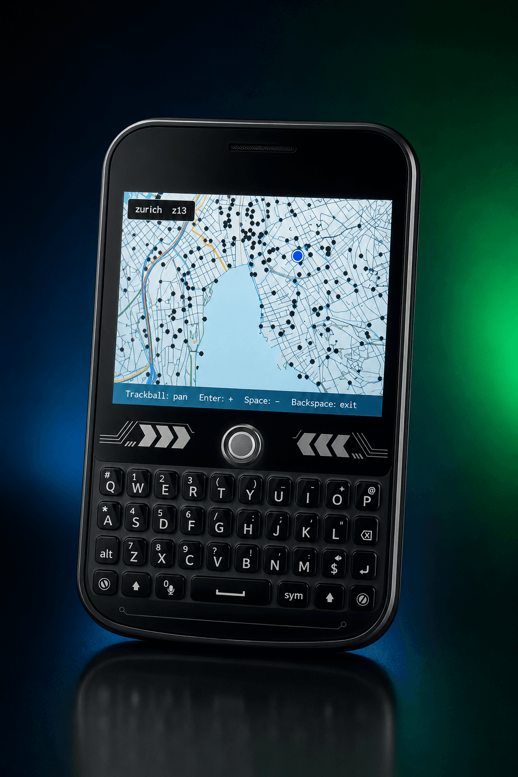
Open compact AGM maps without a network. Pan, zoom, and place your live GNSS position directly on the map.
Send encrypted direct or broadcast messages to nearby AegisNodes. Delivery acknowledgements, retries, and message history work without an SD card.
Translate text and Morse in either direction, inspect coordinates, and use a growing collection of utilities designed for constrained situations.
PURPOSE-BUILT DATA
General-purpose file formats carry costs that matter on constrained hardware. AegisNode uses two proprietary formats built specifically for offline maps and manuals, fitting more useful information into limited storage while requiring less memory, processing, and power to access it.
Packages offline map tiles and navigation data into a compact, device-ready structure. AegisNode can retrieve only the area and zoom level needed instead of processing an oversized general-purpose map.
Stores structured manuals in a compact, indexed format made for the AegisNode reader. Sections, navigation, and search remain available without loading or parsing an entire document.
NAVIGATION / GNSS
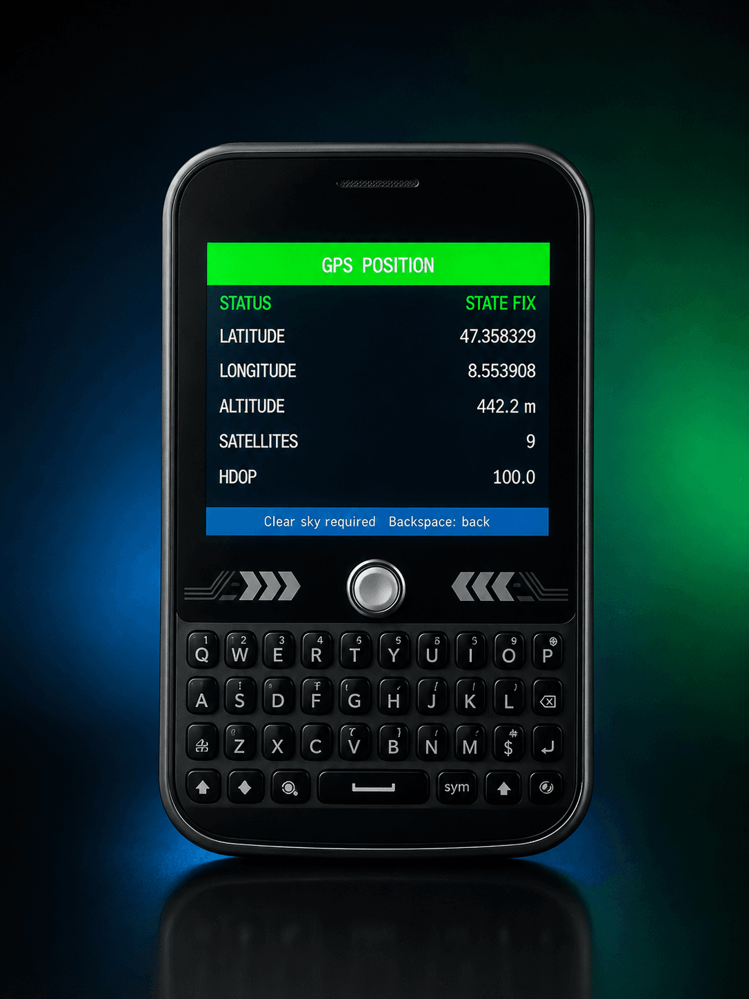
The receiver is activated only when navigation needs it. Once acquired, coordinates can be read directly or overlaid on an offline AGM map.
ONE CODEBASE / TWO DEVICES
The shared firmware architecture supports the color T-Deck Plus and e-ink T-Deck Pro, with hardware-specific display and input layers.
COLOR / TRACKBALL / KEYBOARD

E-INK / KEYBOARD / LOW REFRESH
DESIGN PRINCIPLE
“A critical tool should not become useless because a server, subscription, or signal disappeared.”
AegisNode stores core content locally, minimizes unnecessary radio and screen activity, and keeps vital messages in onboard flash.
FIELD SOFTWARE

COMMON QUESTIONS
AegisNode is a survival-first, offline field computer designed to keep essential knowledge, navigation, messaging, and practical tools available when internet and cellular infrastructure are unavailable.
No. Its core manuals, maps, GPS functions, field tools, and nearby LoRa messaging are designed to work locally without cloud access or a subscription.
The shared firmware supports the color LILYGO T-Deck Plus and the low-refresh e-ink T-Deck Pro through hardware-specific display and input layers.
AegisNode is currently in active development, with working firmware on two devices. You can join the project update list for hardware, firmware, and field-testing milestones.
FOLLOW THE BUILD
Join the update list for firmware milestones, hardware progress, and field testing.